Hydroclimate Data Retriever#


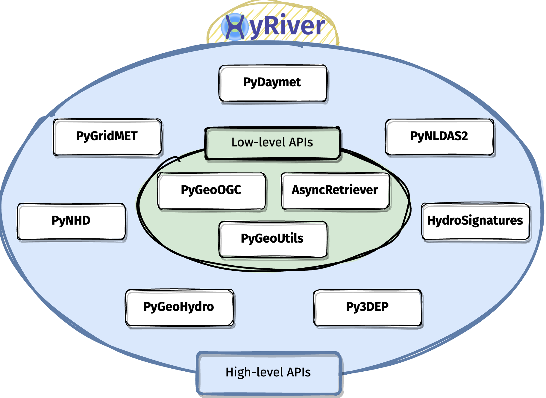
HyRiver (formerly named hydrodata) is a suite of Python packages that provides a unified API for retrieving geospatial/temporal data from various web services. HyRiver includes two categories of packages:
Low-level APIs for accessing any of the supported web services, i.e., ArcGIS RESTful, WMS, and WFS.
High-level APIs for accessing some of the most commonly used datasets in hydrology and climatology studies. Currently, this project only includes hydrology and climatology data within the US.
Video Gallery#
Citation#
If you use any of HyRiver packages in your research, we appreciate citations:
@article{Chegini_2021,
    author = {Chegini, Taher and Li, Hong-Yi and Leung, L. Ruby},
    doi = {10.21105/joss.03175},
    journal = {Journal of Open Source Software},
    month = {10},
    number = {66},
    pages = {1--3},
    title = {{HyRiver: Hydroclimate Data Retriever}},
    volume = {6},
    year = {2021}
}
Navigate and subset mid- and high-res NHD, NHDPlus, and NHDPlus VAA using WaterData, NLDI, ScienceBase, and The National Map web services.

Access NWIS, NID, HCDN 2009, NLCD, and SSEBop databases.

Access topographic data through The National Map’s 3DEP web service.

Access Daymet for daily, monthly and annual summaries of climate data at 1-km scale for both single pixels and gridded, over the North America, Hawaii, and Puerto Rico.

Access GridMet for daily climate data at 4-km scale for both single pixels and gridded data, over the conterminous United States.

Access hourly NLDAS-2 forcing data.

A collection of tools for computing hydrological signatures

Send queries to and receive responses from any ArcGIS RESTful-, WMS-, and WFS-based services.

Convert responses from PyGeoOGC’s supported web services protocols into geospatial and raster datasets.

Asynchronous send/receive requests with persistent caching.
